Mohawk Central.
Valley story · Erie Canal & expansion

Little Falls: the city the river built (and squeezed)

Where the Mohawk drops forty feet through a rock gorge, everything had to squeeze through: canoes, then canals, then railroads. The squeeze made Little Falls rich — in water power, in cheese, and in one very tall lock.

Little Falls · 1795–present · 2 min read · Last fact-checked Jul 17, 2026
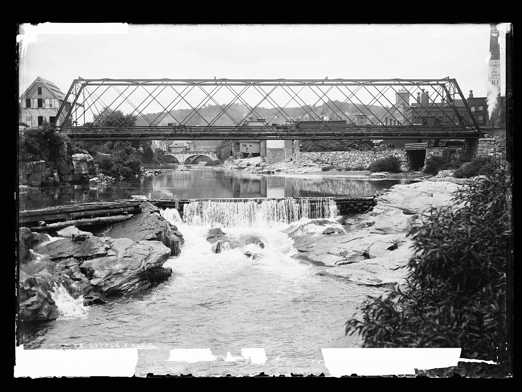
An iron truss bridge spanning a rocky river gorge with a low waterfall in the foreground, mill buildings and a stone arch bridge visible beyond.
The Mohawk at Little Falls, photographed in the late 1800s — truss bridge above, mill town beyond the rocks. (ca. 1880)Detroit Publishing Co. — Library of Congress, Prints & Photographs Division · No known restrictions on publication. View original ↗

First around the falls

The falls that named the city were the worst obstacle on the whole Mohawk route — roughly a forty-foot drop through a gorge that forced every canoe and bateau to portage.1 So it's no accident that one of America's earliest canals was built here: in 1795 the Western Inland Lock Navigation Company opened a five-lock canal around the falls, a generation before the Erie.12 Pieces of that pioneering work survive on Moss Island's flank.

The Erie Canal followed through the gorge in the 1820s, the railroad in the 1830s, and the Barge Canal in 1918 — the last bringing Lock 17, whose 40.5-foot lift is the highest on the canal system and was for years described as the tallest of any lock in the world.3 Boats still ride its chamber every summer.

Cheese capital

The gorge gave Little Falls water power for mills; the surrounding hill farms gave it something to sell. After the cheese-factory system spread from Rome in the 1850s, Little Falls became one of the nation's great cheese markets — for a stretch of the late 1800s, dairy buyers set national prices in its market square before the trade consolidated elsewhere.

Mills wove and knitted along the raceways into the 20th century, then wound down like the rest of the Valley's textile trade. What stayed is the bones: a compact stone-and-brick downtown, mill buildings turned shops at Canal Place, and the strange, beautiful potholed rock of Moss Island, now climbed for fun rather than portaged out of necessity.

Timeline

Sources & further reading

Numbers match the citations in the text
  1. The Western Inland Lock Navigation Canal (walking-tour history) ↗ — Little Falls Historical Society
  2. Early New York State Waterways & the Inland Lock Navigation Company ↗ — National Park Service
  3. Erie Canal Locks — locations and lifts (Lock E-17, 40.5 ft) ↗ — OffshoreBlue Cruising Guides
  4. Little Falls Physical Layout (Moss Island National Natural Landmark) ↗ — My Little Falls
  5. New York State Canal Corporation ↗ — NYS Canals
  6. Herkimer County Historical Society ↗ — Herkimer County Historical Society

Related stories

Spot a mistake, or have material that adds to this story? Tell us. Last fact-checked Jul 17, 2026 · All history ↑